
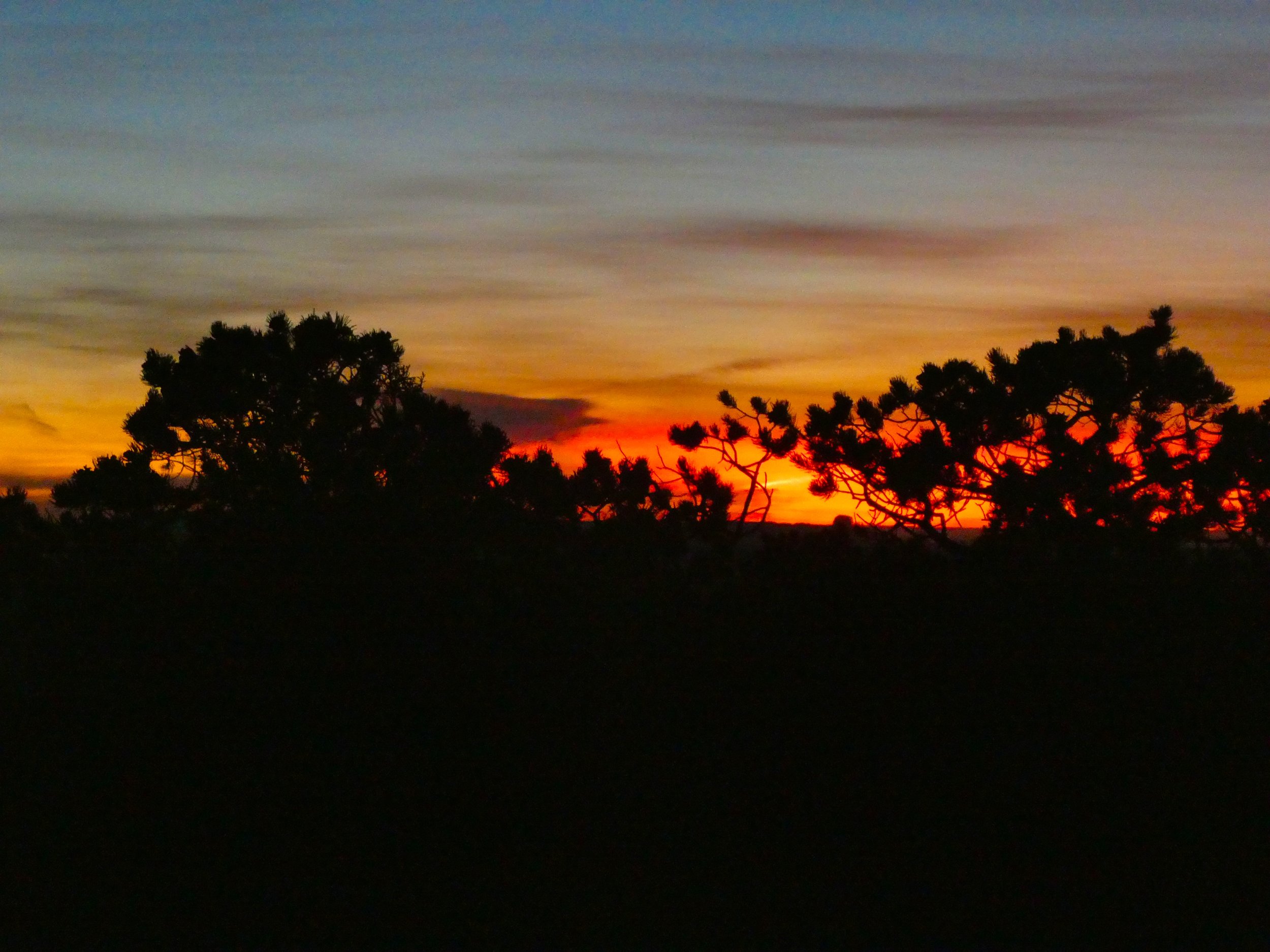
Sun setting as we drive in to the cabin
Independent Writers Conference
We met many "Rock Stars" of the independent publishing industry who unselfishly shared their experience and expertise. Now, we have a long list of "to-do's" to help promote Sally’s book to a wider audience.
The conference ignited Sally’s enthusiasm to get started on her next book 📚

Steven Spatz, President of BookBaby Publishing

Professor Jane Friedman, self publishing and independent author guru!

Children’s Book Alliance board member requested a copy of Sally’s book.

Dana Kaye, author branding expert

Mathew, incredibly capable author support, BookBaby team

Miral Sattar, SEO technical expert

The Awesome BookBaby team
A Great Day in Philadelphia With Sandy and Andy
Food, wine and the Museum of the American Revolution

Sosso Italian Restaurant

The girls on the loose!

Frieda Cafe

China Team Reunion
We shared a meal and memories of living in China together. What fun. What funny stories!
Just Arrived - Independent Author’s Conference
Excited to arrive at the Independent Authors Conference...
Read More
An "Old-Fashioned" Wyoming Horseback Elk Hunt
We experienced remote, wild and beautiful country on horseback and afoot, saw seven grizzly bears, an even dozen wolves, bison, moose and many hundreds of elk. How would it get better than this?
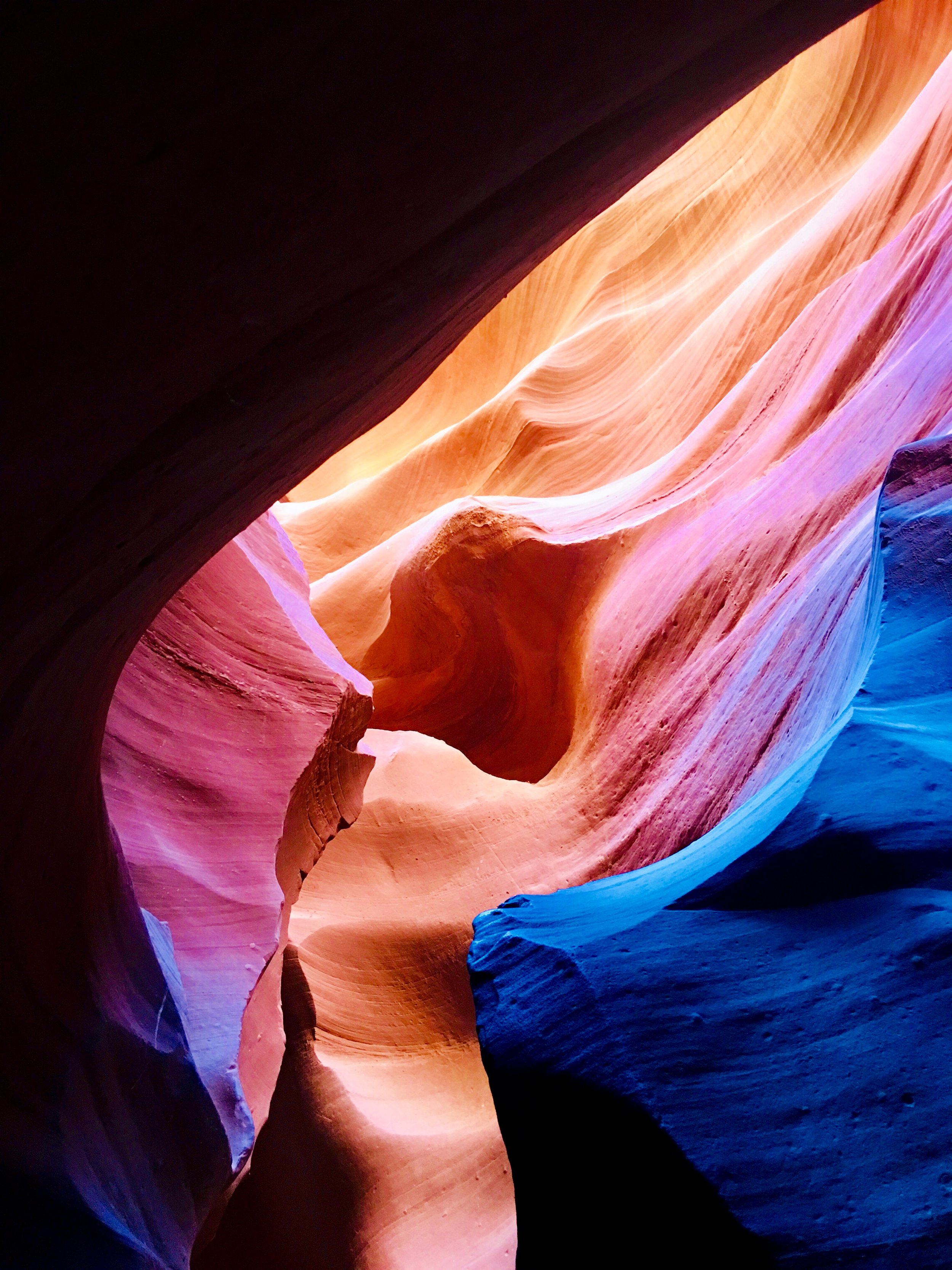
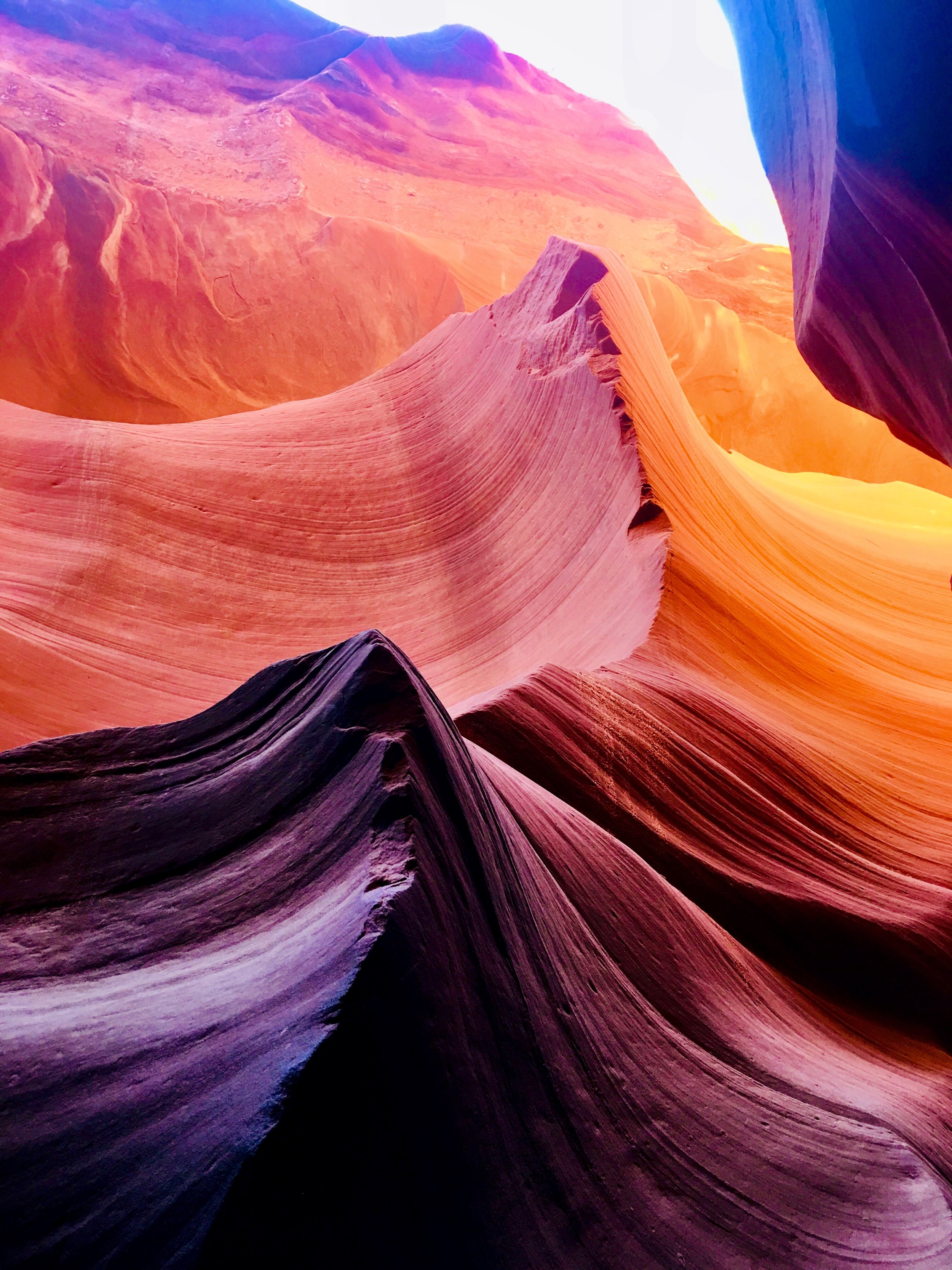
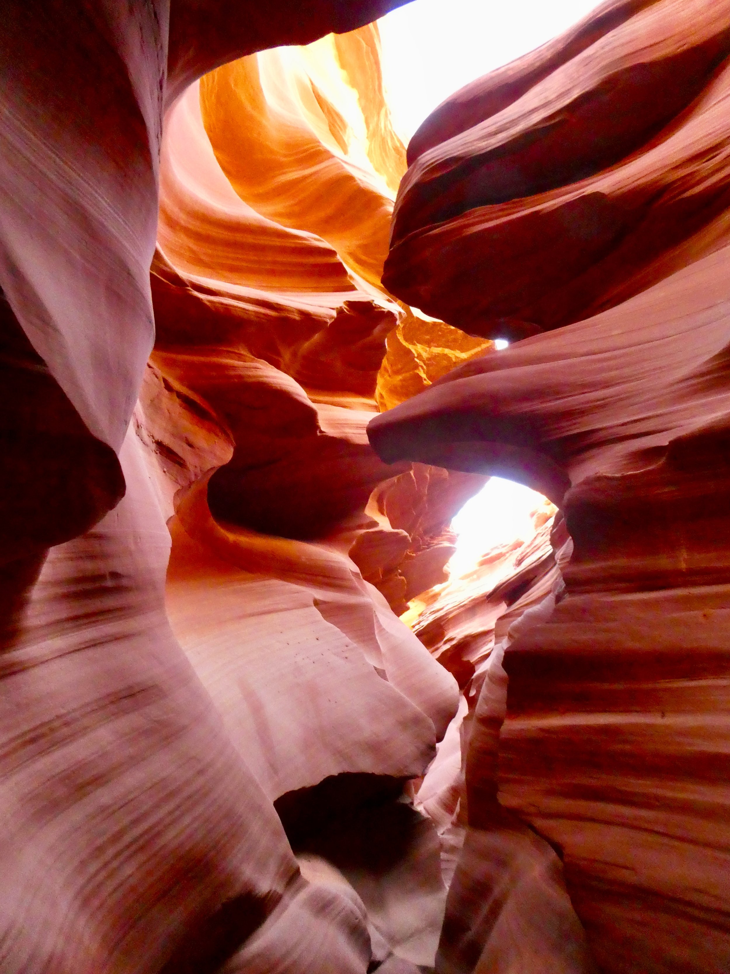
Read MoreLower Antelope Canyon and the Navajo National Monument
Lower Antelope Canyon

“Antelope Canyon is located near Page on Navajo Nation land, just outside Glen Canyon National Recreation Area. Antelope is the most visited slot canyon in the Southwest, partly because it is easily accessible and by far the most publicized, and also since it is extremely beautiful, with just the right combination of depth, width, length, rock color and ambient light; many other slot canyons are deeper, narrower or longer, and some have rock that is even more colorful and sculptured, but here conditions are ideal.”

Our Hopi guide, Mathew, takes us down into the Canyon


“Antelope Canyon was formed by erosion of Navajo Sandstone, primarily due to flash flooding and secondarily due to other sub-aerial processes. Rainwater, especially during monsoon season, runs into the extensive basin above the slot canyon sections, picking up speed and sand as it rushes into the narrow passageways. Over time the passageways eroded away, making the corridors deeper and smoothing hard edges in such a way as to form characteristic "flowing" shapes in the rock.”


Navajo National Monument
“Navajo National Monument is a National Monumentlocated within the northwest portion of the Navajo Nation territory in northern Arizona, which was established to preserve three well-preserved cliff dwellings of the Ancestral Puebloan People: Broken Pottery (Kitsʼiil), Ledge House (Bitátʼahkin), and Inscription House (Tsʼah Biiʼ Kin). The monument is high on the Shonto plateau, overlooking the Tsegi Canyon system, west of Kayenta, Arizona. It features a visitor center with a museum, two short self-guided mesa top trails, two small campgrounds, and a picnic area. Rangers guide visitors on free tours of the Keet Seel and Betatakin cliff dwellings.“

Betatakin Site
After a short hike to view the Betatakin cliff dwelling, we settled into our lovely campsite for the evening. This time of year, the campground was nearly empty and is always free of charge!


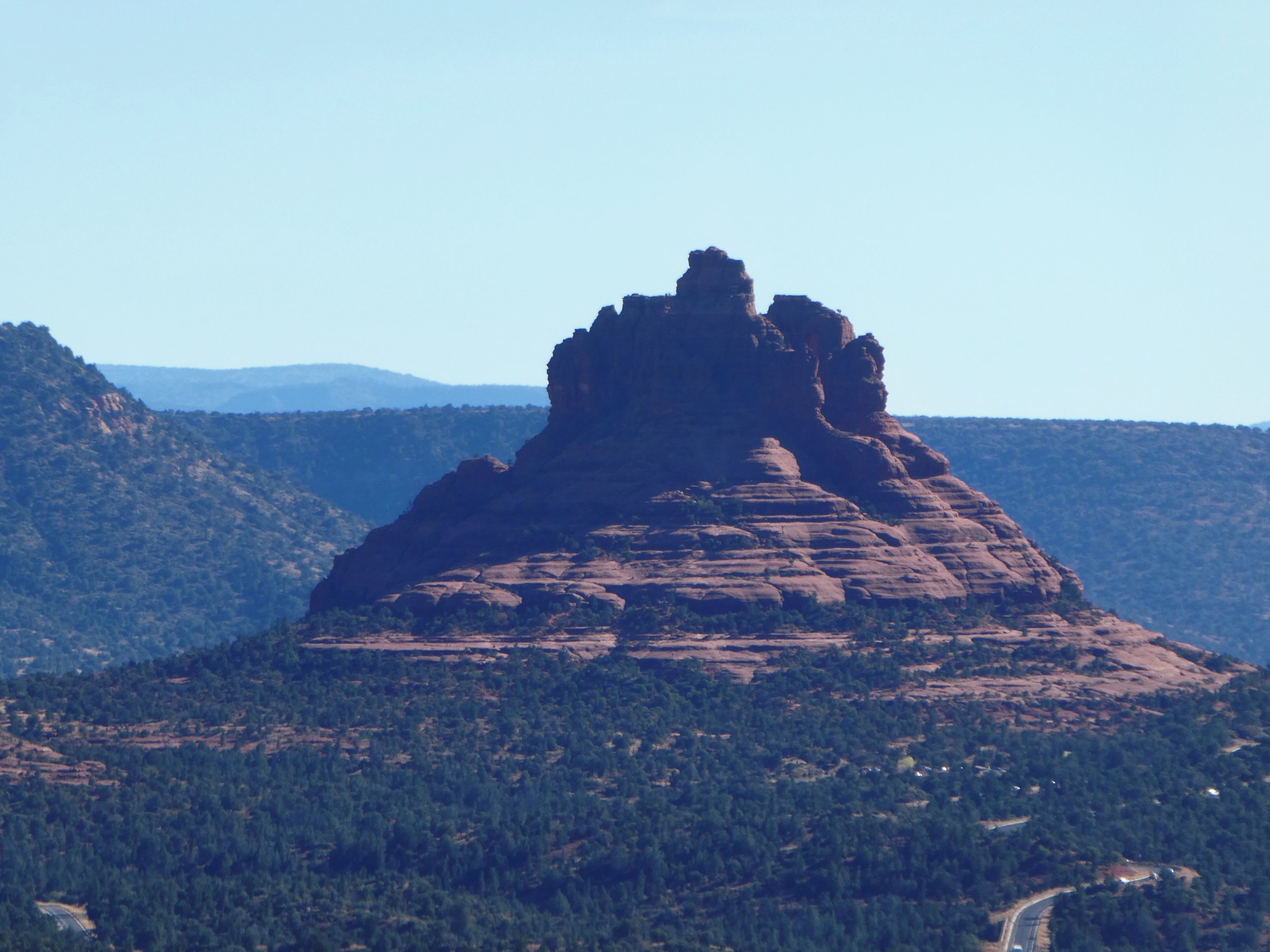
Sedona Arizona
“Sedona is an Arizona desert town near Flagstaff that’s surrounded by red-rock buttes, steep canyon walls and pine forests. It’s noted for its mild climate and vibrant arts community. Uptown Sedona is dense with New Age shops, spas and art galleries. On the town’s outskirts, numerous trailheads access Red Rock State Park, which offers bird-watching, hiking and picnicking spots.
Dramatic sandstone formations such as Cathedral Rock and Bell Rock appeal to photographers and enlightenment-seekers, as does the modernist Chapel of the Holy Cross, built into rust-colored rocks. Oak Creek Canyon has trails for hiking and mountain biking, plus sites for camping and fishing.”
Oak Creek Canyon


Airport Mesa Loop Trail
After visiting one of the four famous Sedona vortexes, we enjoyed a beautiful 4.5 mile sunset hike around Tabletop Mesa.
“There is no other hike in the Sedona area that offers such awe-inspiring views as the Sedona Airport Mesa Loop Trail. It offers hikers a 360-degree panorama with views of almost every major red-rock landmark along the perimeter at an elevation of 4,500 feet.”


Death Valley National Park

With 3 million acres of wilderness, Death Valley is the largest national park outside Alaska. Elevations in the park range from -282 feet below sea level at Bad Water (the lowest point in North America), to 11,049 feet at Telescope Peak.
The park encompasses 3.3 million acres and normally enjoys summer temperatures in the 110’s and 120’s, but also experienced a record temperature of 134 degrees Fahrenheit. It is considered the hottest place on earth and the driest place in the United States.
Of the more than 900 plant species found, 19 are unique to this area.
Driving in from the south as the sun sets, we make our way up a narrow winding road to the Wildrose Campground at 4,100 ft elevation. The mountains being much cooler than the surrounding desert, the temperature dropped quickly from 72 degrees, down to a low of 31 degrees in the early morning.
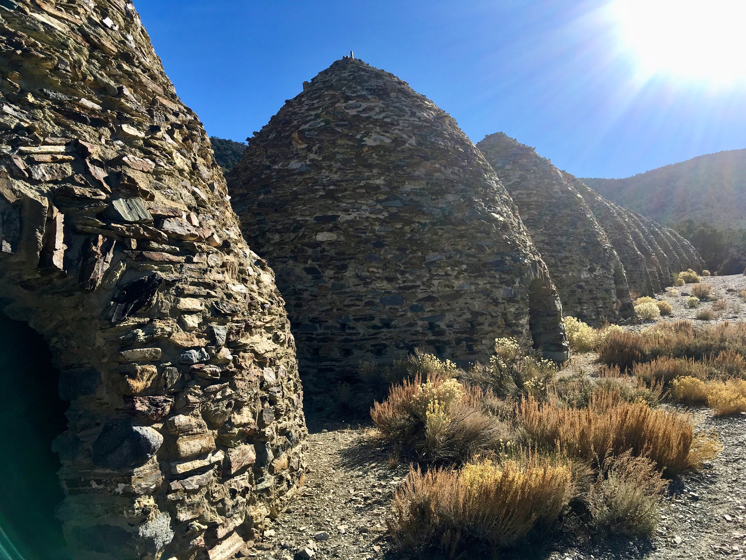
Up early at Wildrose Campground, we drove the dirt road up Wildrose Canyon toward the Charcoal Kilns and Mahogany Flats.

The 25’ high Charcoal Kilns were used to produce charcoal to smelt lead and silver from local ore mined beginning in 1877, and ceased operations shortly afterward.

Charcoal Kilns
After the Kilns, the 4WD Road gets a bit rough, climbing to the Mahogany Flats Campground and the road’s end at 8,133 ft.

Wildrose Canyon Road - pretty rough

The view into the valley from Mahogany Flats
Returning the way we came, we head for the Visitor’s Center to view the exhibits and plan a sunset photo tour of the park.
On the way, we encounter a small herd of feral donkeys, turned loose after mining operations ceased in the late 19th century.
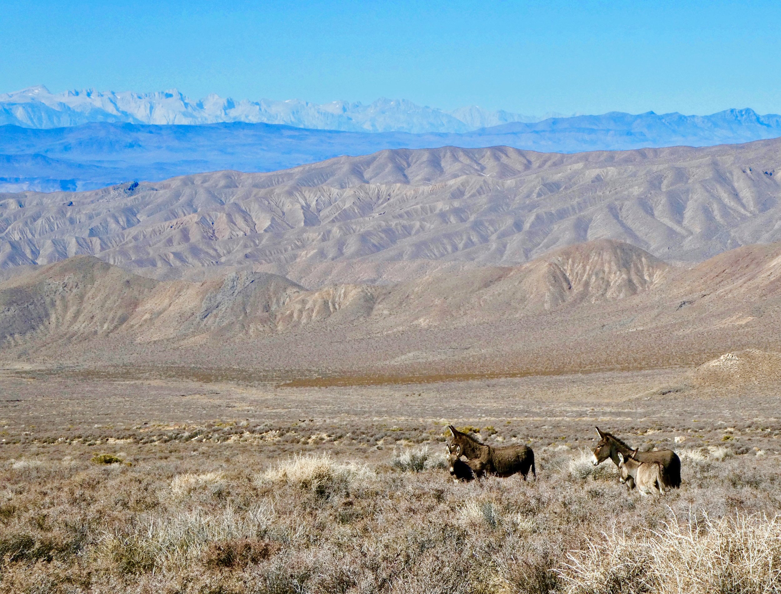

Hey doncs!
From the Visitor’s Center we set out for Bad Water Basin and Artists Drive before the sunset. On the way we pause at the Harmony Borax Works and an example of the “20 Mule Team” borax mining transportation and extraction methods.
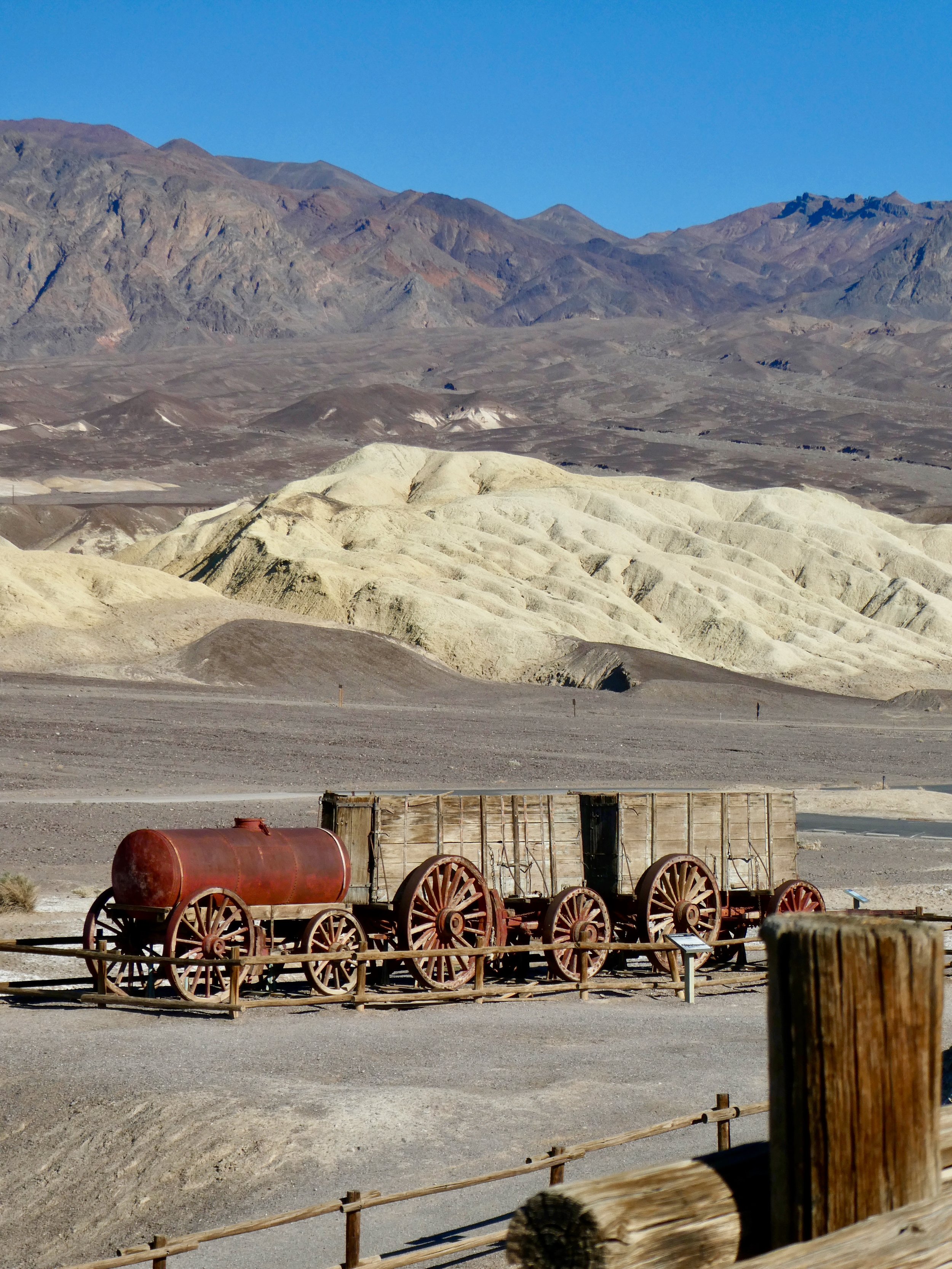
Next stop: Badwater Basin
“Badwater Basin is an endorheic basin in Death Valley National Park, noted as the lowest point in North America, with a depth of 282 ft (86 m) below sea level. Mount Whitney, the highest point in the contiguous 48 United States, is only 84.6 miles (136 km) to the northwest.
The site itself consists of a small spring-fed pool of "bad water" next to the road in a sink; the accumulated salts of the surrounding basin make it undrinkable, thus giving it the name.”


From Bad Water we quickly travel to Artists Drive to attempt to capture the beautiful mineral colors in the hot light of sunset.
“Artist's Drive rises up to the top of an alluvial fan fed by a deep canyon cut into the Black Mountains. Artist's Palette is an area on the face of the Black Mountains noted for a variety of rock colors. These colors are caused by the oxidation of different metals (iron compounds produce red, pink and yellow, decomposition of tuff-derived mica produces green, and manganese produces purple).
Called the Artist Drive Formation, the rock unit provides evidence for one of the Death Valley area's most violently explosive volcanic periods. The Miocene-aged formation is made up of cemented gravel, playa deposits, and volcanic debris, perhaps 5,000 feet (1500 m) thick. Chemical weathering and hydrothermal alteration cause the oxidation and other chemical reactions that produce the variety of colors displayed in the Artist Drive Formation and nearby exposures of the Furnace Creek Formation.”


Artists Palette


Artists Drive is a very narrow one-way road restricted to vehicles less than 25 feet in length

Alas, dusk put an end to our photographic endeavors, but a sunset dinner back at our campsite provided more than adequate recompense.

There is so much to experience in Death Valley and we have barely scratched the surface. We will undoubtedly return!
Tomorrow, on to Flagstaff and Sedona Arizona.
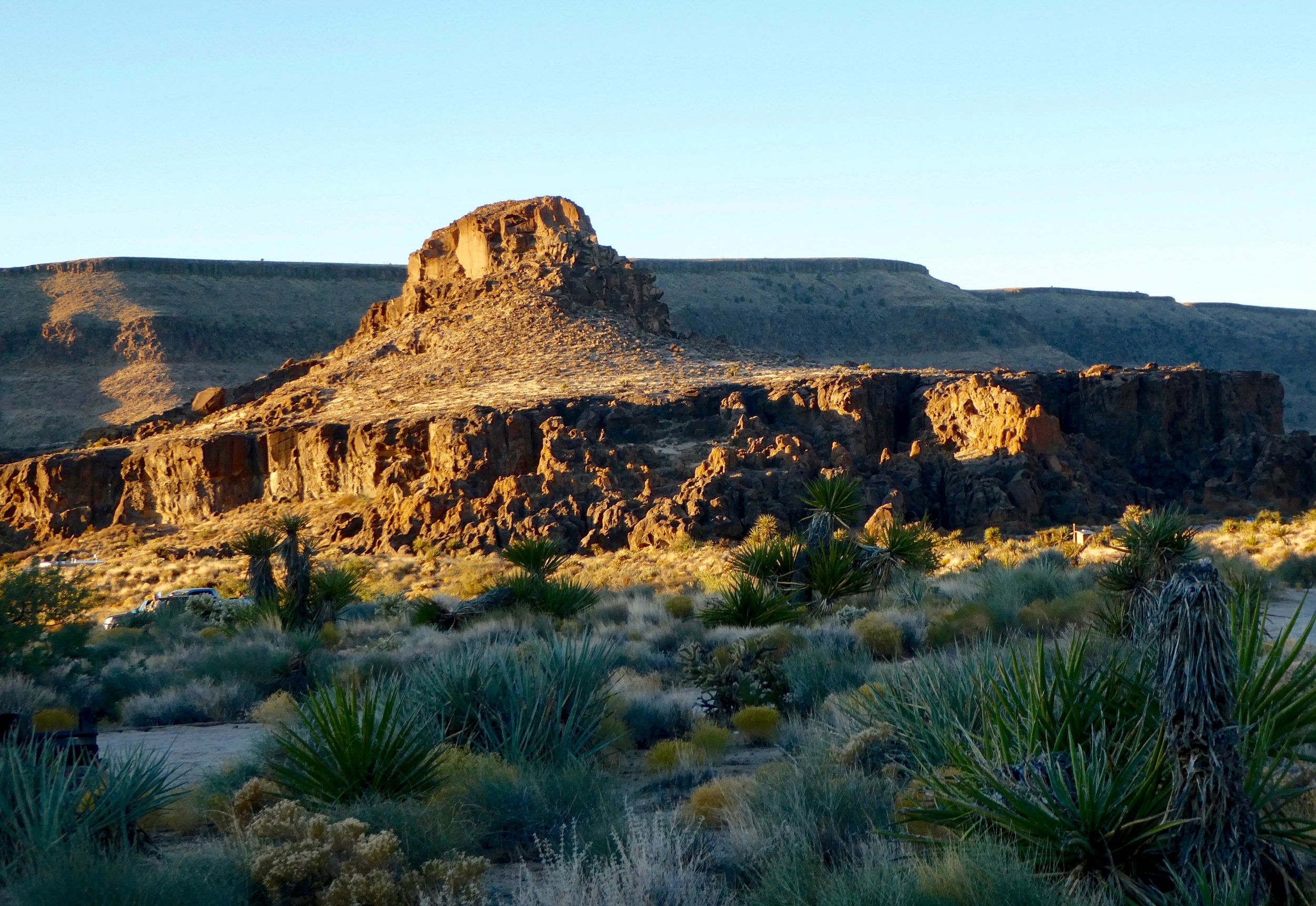
Mojave National Preserve
Driving South from the from Las Vegas, the road turns from paved to dirt and then to very rough dirt. Not awful, but the Park Service does advise 4WD vehicles only. The desert dusk scenery is lovely and I am the only vehicle on this 40 mile stretch of road. I find plenty of open campsites at Hole-in-The-Wall Campground and settle in for the night
The Mojave National Preserve encompasses 1.6 million acres, including portions of the Mojave, Great Basin and Sonoran Deserts About half of the Park is congressionallly designated wilderness.
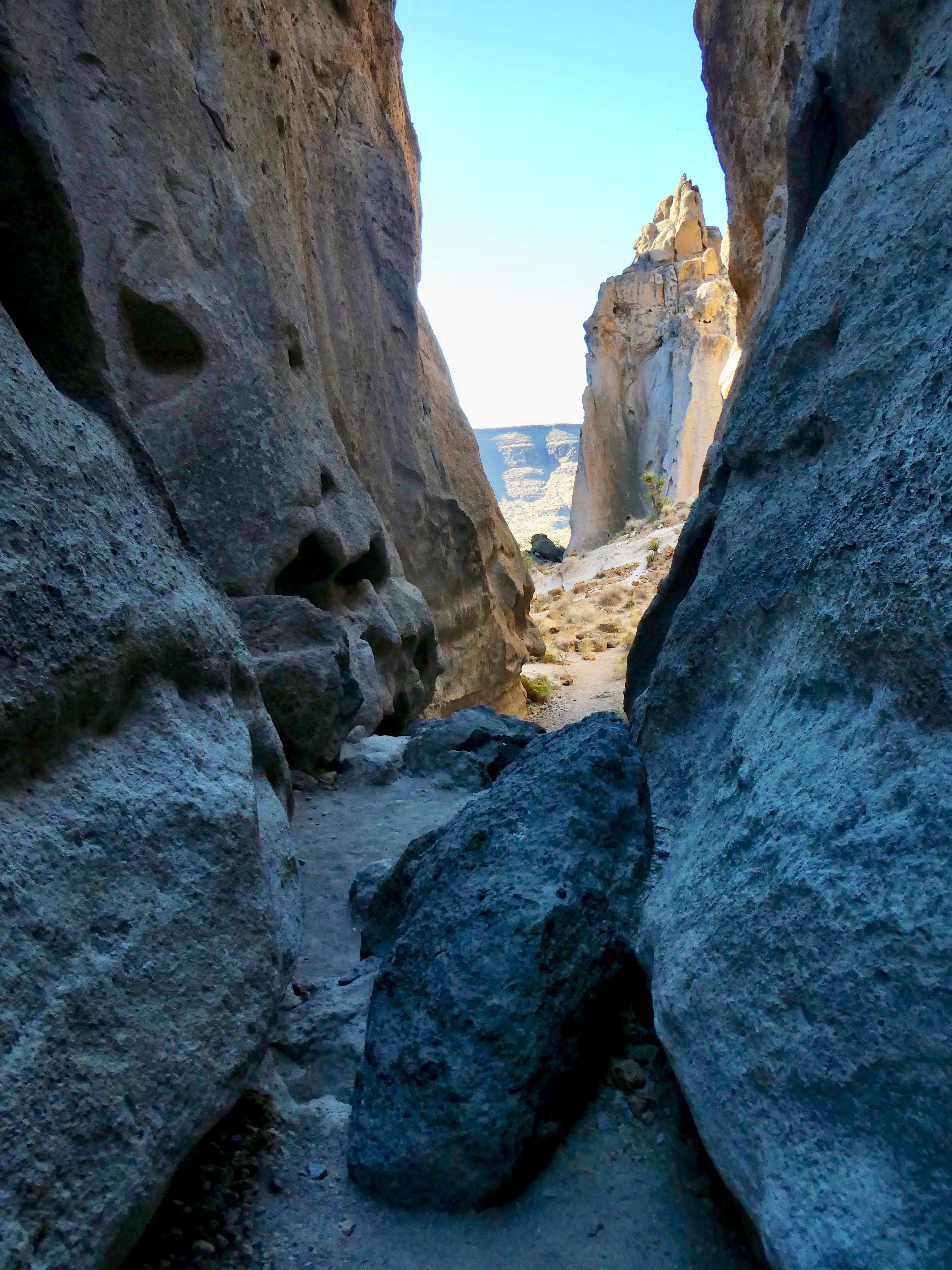
Sunrise Hike: Rings Loop Trail, Hole-in-the-Wall Nature Trail and Barber Peak Loop Trail
Sunrise at Hole-In-The-Wall Campground

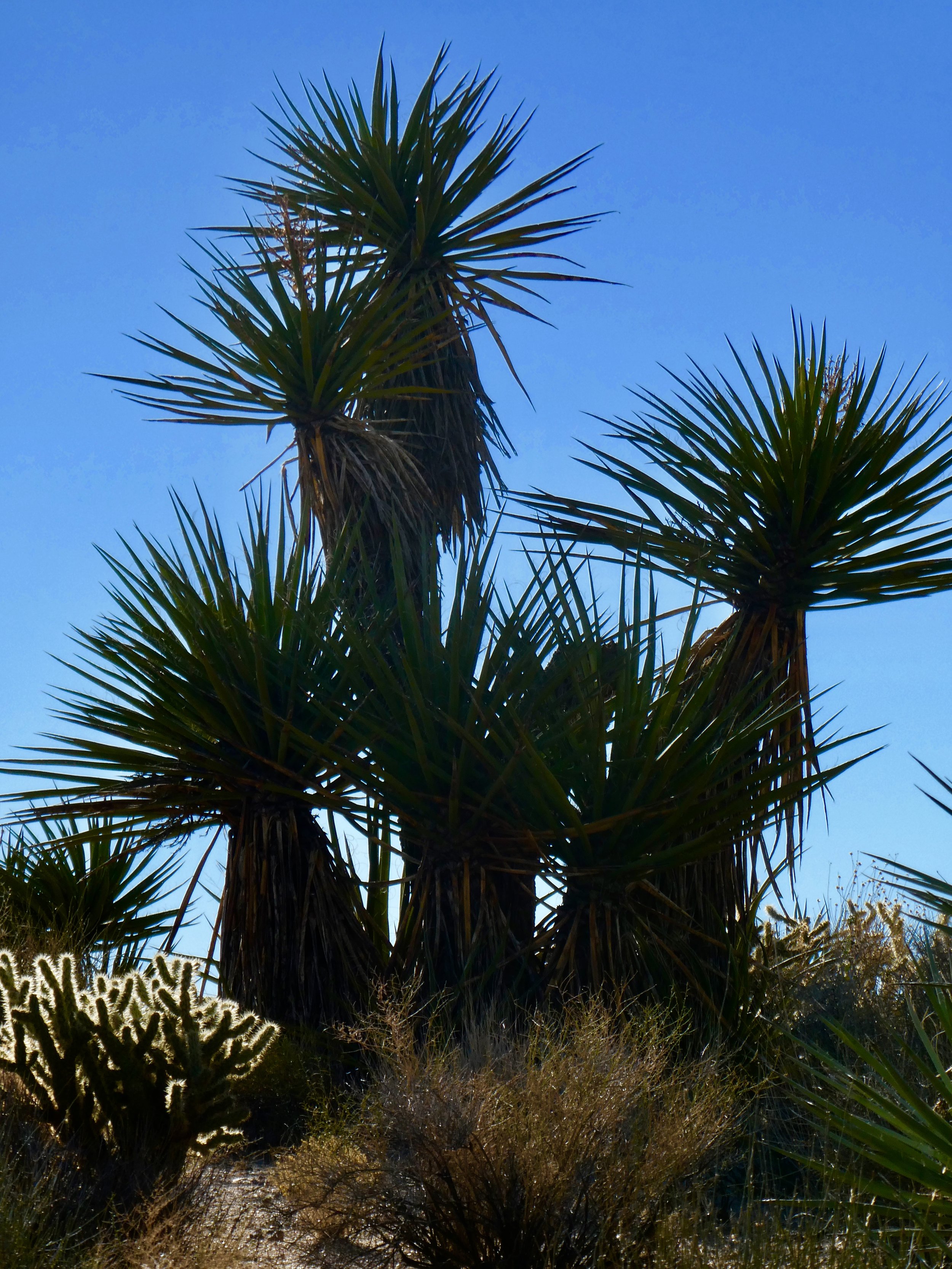
Mojave Yucca

Buckhorn Cholla Cactus
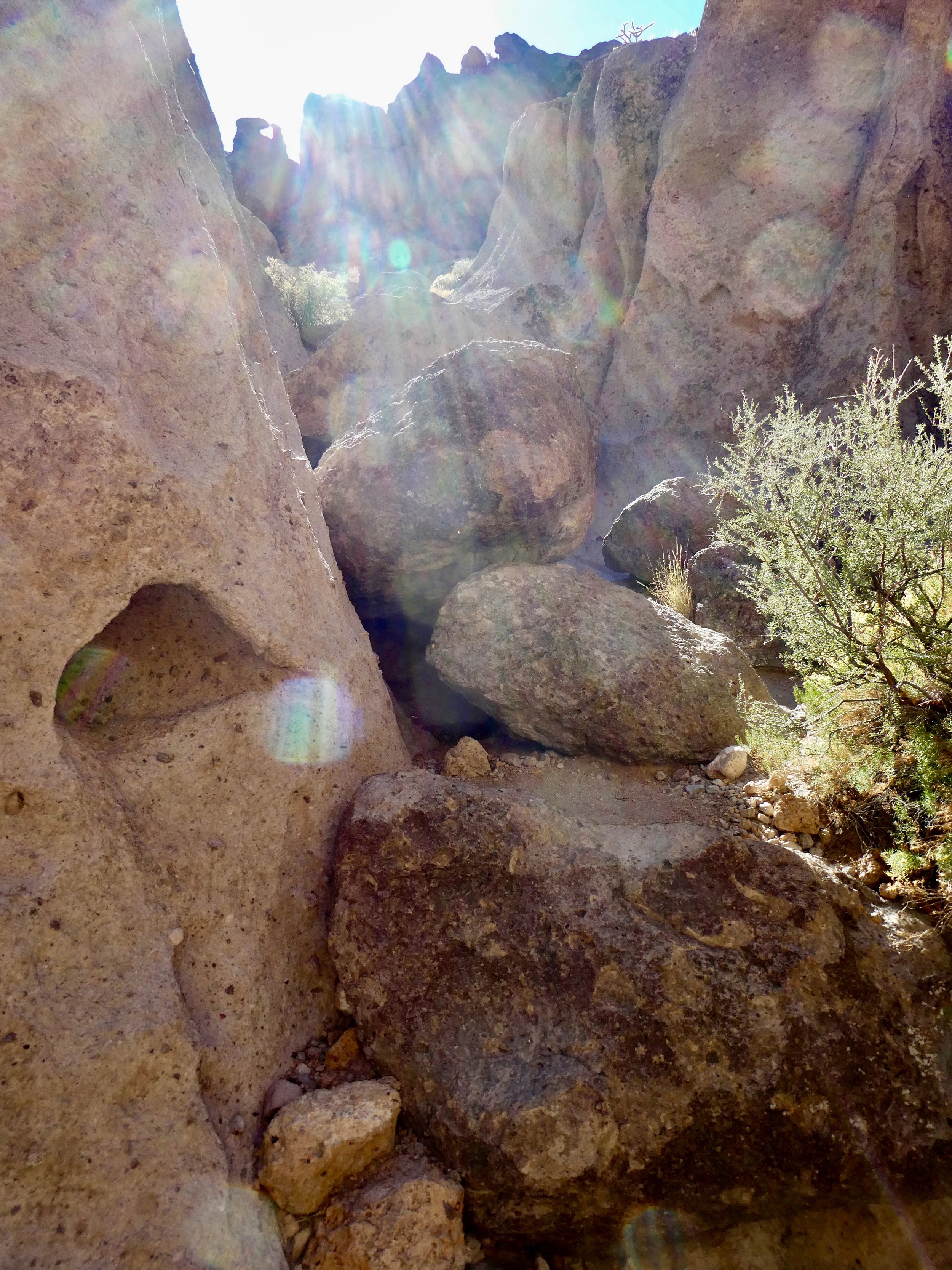
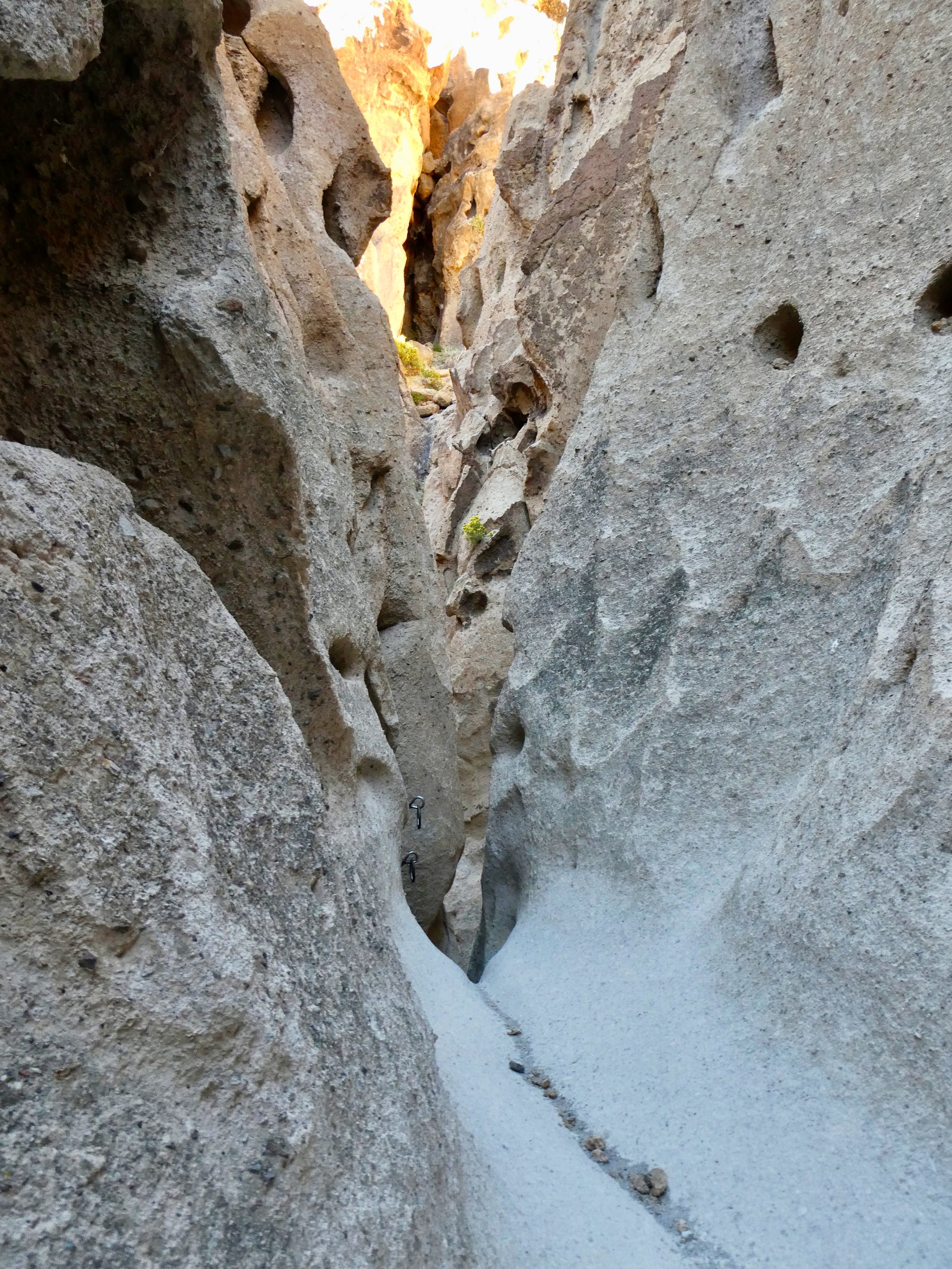
Banshee Canyon
The ascent is so steep, hikers climb up using iron rings mounted in the rock for hand and toe holds on two sections.


Beavertail Cactus
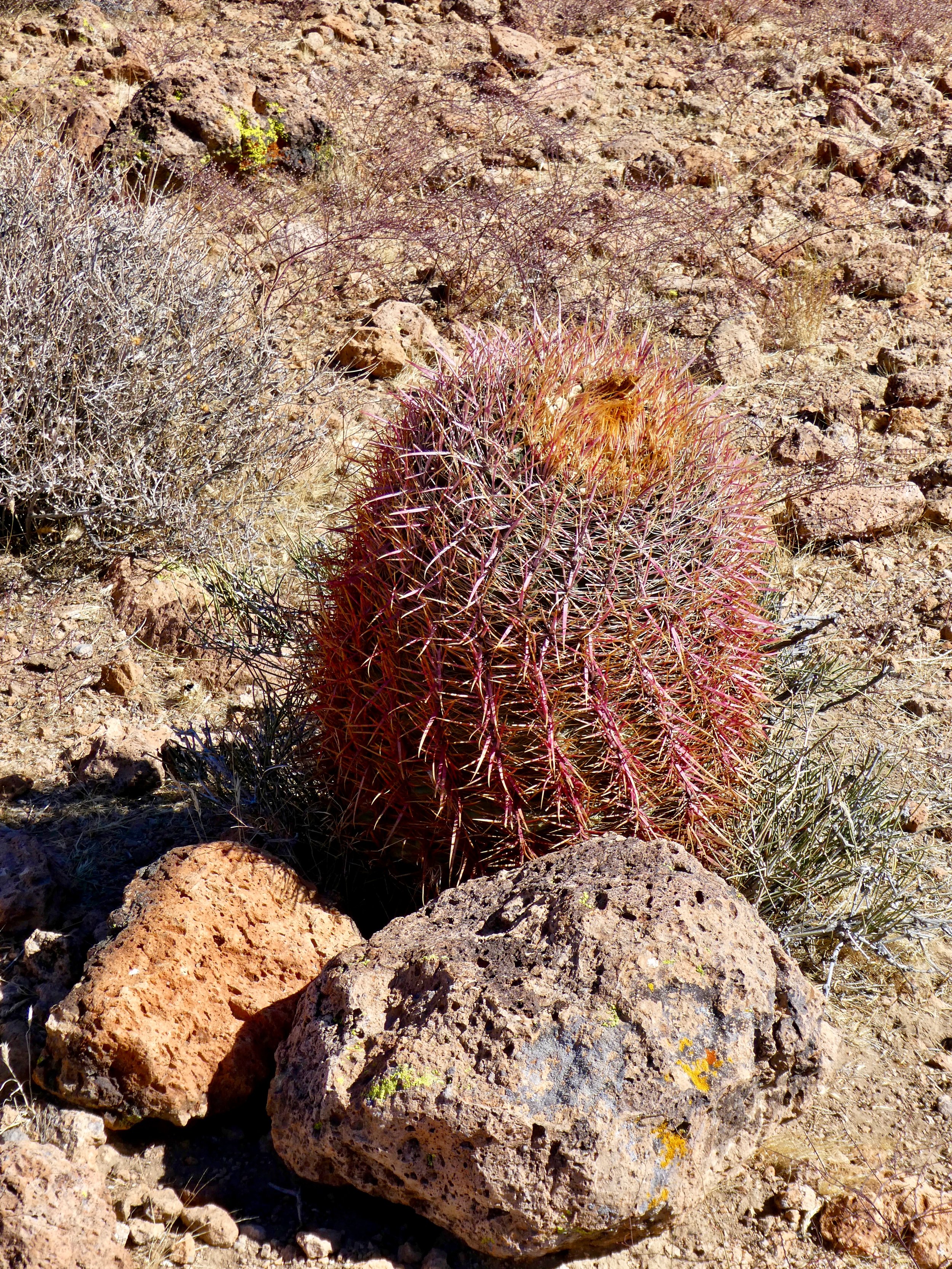
Barrel Cactus

The colorful Mojave landscape
Although the landscape appears barren, the Mojave desert is home to a plethora of wildlife including Bighorn Sheep, and the Desert Tortoise.

Sunset
Enjoying a Beautiful Sunset Dinner with a Herd of Antelope at 8,500 feet.
Just anothe beautiful evening at Willett's Kopje Creek Cabin ⛰
Read MoreColorado Backcountry Camping Above 10,000 Feet
Sally's first nights in a tent in over 30 years (she, of course was 9 years old then.....🏕
Read MoreMesa Verde Motorcycle Tour
I'm still having a blast on my motorcycle!
Read MoreTouring The Black Hills and Badlands of South Dakota
Spring camping trip from Colorado, through western Nebraska, western South Dakota, central Wyoming and back. Nine days of Natural Wonder!
Read MoreRainy Spring Days in the Mountains
We count ourselves so lucky to have such a wonderful retreat!
Read MoreMoab Utah: Spring Camping and Hiking in Arches and Canyonlands National Parks
My friends Ray and Shirley had only been home a few weeks, but were getting restless to get their camper back on the road. They invited me to tag along on a five-day excursion to explore the lovely parks located near Moab, Utah. It has been years since we were last here.
Read MoreA Beautiful Family Photo Shoot in the back alleys of Shanghai
by Wang Gang Fang, Gang Of One Photography, January, 2006.
Read MoreHalloween 2016 🎃
".....I aint afraid of no ghosts...."
Read More